

Flash Flood Watch
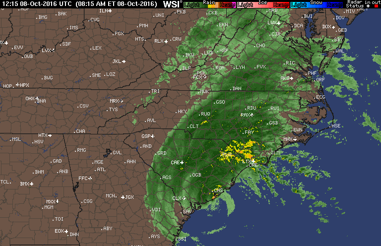
Excessive rainfall is expected over much of the central and eastern portions of North Carolina into Sunday.
As Hurricane Matthew tracks northeastward along the South Carolina coast today and the far southeastern coast of NC tonight. Periods of heavy rain are expected over much of Central and Eastern North Carolina.
Flash Flood Watch remains in effect through Sunday afternoon.
The Flash Flood Watch continues for.
A portion of central North Carolina, including the following areas, Anson, Cumberland, Edgecombe, Franklin, Halifax. Harnett, Hoke, Johnston, Lee, Montgomery, Moore, Nash. Richmond, Sampson, Scotland, Stanly, Wake, Wayne and Wilson.
Through Sunday afternoon.
Heavy rain is expected over the watch area including the Sandhills. Southeast Piedmont. And coastal plain today and tonight. Ending Sunday. Storm total rainfall of 5 to 10 inches is expected. And there could be locally 12 inches of rain over portions of the coastal plain.
Soils in this area are already saturated with the widespread rain of Friday and Friday night. The arrival of heavy rain bands associated with Hurricane Matthew will run off quickly creating flash flooding. Flooding may also occur on larger rivers.
Recommended actions
A Flash Flood Watch means that conditions are favorable for flash flooding. Flash Flooding is a very dangerous situation. Be prepared to move to higher ground if flooding is observed or if a warning is issued. Never drive into water of unknown depth.


